Sheffield city centre wip, created from Google photogrammetry using the Google Earth Decoder by Jonahex111. The Decoder is an excellent tool for those like me who want to make some scenery but don't have any Blender or other modelling skills, and there's a handy tutorial for how to go about doing it all by Flying Theston here.
Some minor changes the first version, including a few added night lights. I used some of the very useful Miguel88's colour lights for this.
To install just extract the file into your Community folder.
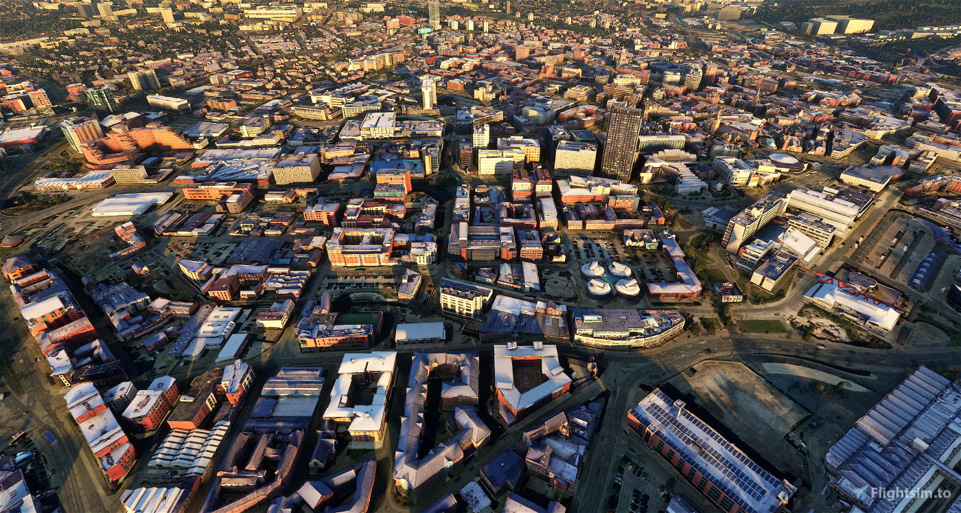
Sheffield City Centre is a district of the City of Sheffield. It includes the area that is within a radius of roughly 0.75 miles (1.2 km) of Sheffield Cathedral, and is encircled by the Inner Ring Road—a circular route started in the late 1960s and completed in 2007. As well as the cathedral, buildings in the city centre include the Grade I listed Town Hall, the City Hall, and the Winter Gardens. Several areas of the city centre have been designated as quarters. It is home to the city's major business, transport, leisure and cultural attractions. The City centre is currently undergoing massive re-generation with every section of the City centre set to be re-developed. Plans and projects include the development of new squares and public spaces, new residential and office buildings including St. Pauls Tower, Velocity Living, and the under-construction Velocity Tower, the Sevenstone and Moor shopping areas, redevelopment of existing buildings such as the Crucible Theatre and better transport and shopping facilities and new cultural attractions such as museums and art galleries.
Reviews
Thank you for doing my home city. Don't know if its just me but it seems to have a green tint to it when flying low, but apart from that its fantastic, would be great if you could extend towards Meadowhall and Penistone road towards Hilsboro'' hanks again
4 years ago

Thanks so much for this - Sheffield looks so much better now! Some minor feedback - the land around the Parkway near Park Square roundabout looks quite rocky, and could do with a bit more love, and the incinerator by the Parkway looks a bit off as well - looks like it's right on the edge of where you've stopped and the building is chopped in half or very narrow 😀
Thanks again though - would love to see more of Sheffield mapped like this, great work.
Thanks again though - would love to see more of Sheffield mapped like this, great work.
4 years ago

Comments
Je tu docela prázdno.

4 years ago
4 months ago
theo2012
LatteMaster
Can you do Leeds City Center?
4 years ago
Speeddeamon83
Thanks again though - would love to see more of Sheffield mapped like this, great work.
4 years ago
SuperBladesman