
Introduction:
Thank you for downloading our scenery - version 1.1
It is my favorite airport in the USA. Therefore, I have decided to share this scenery with you.
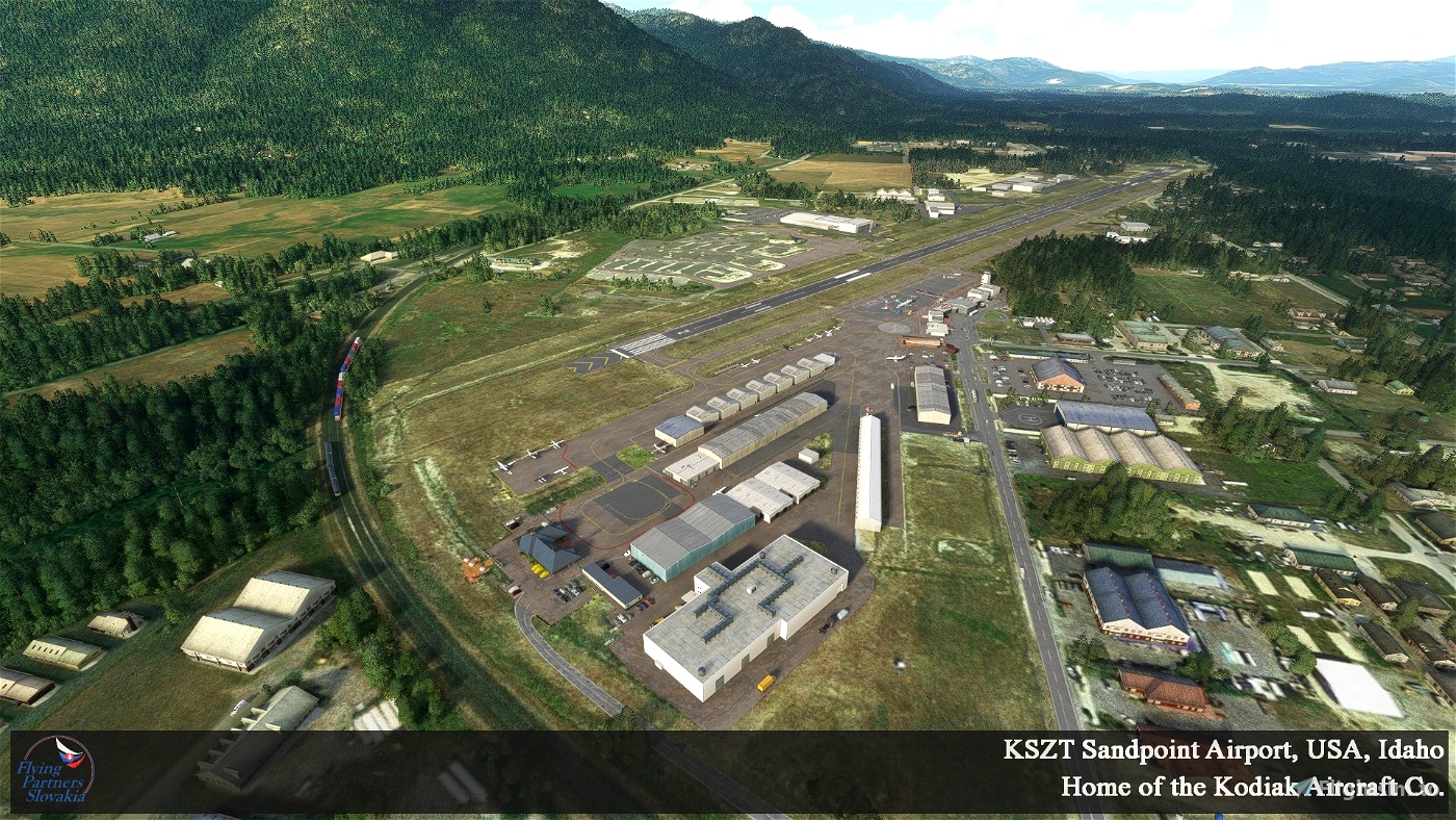
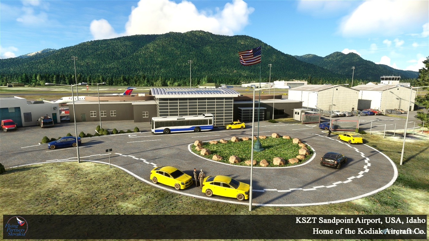
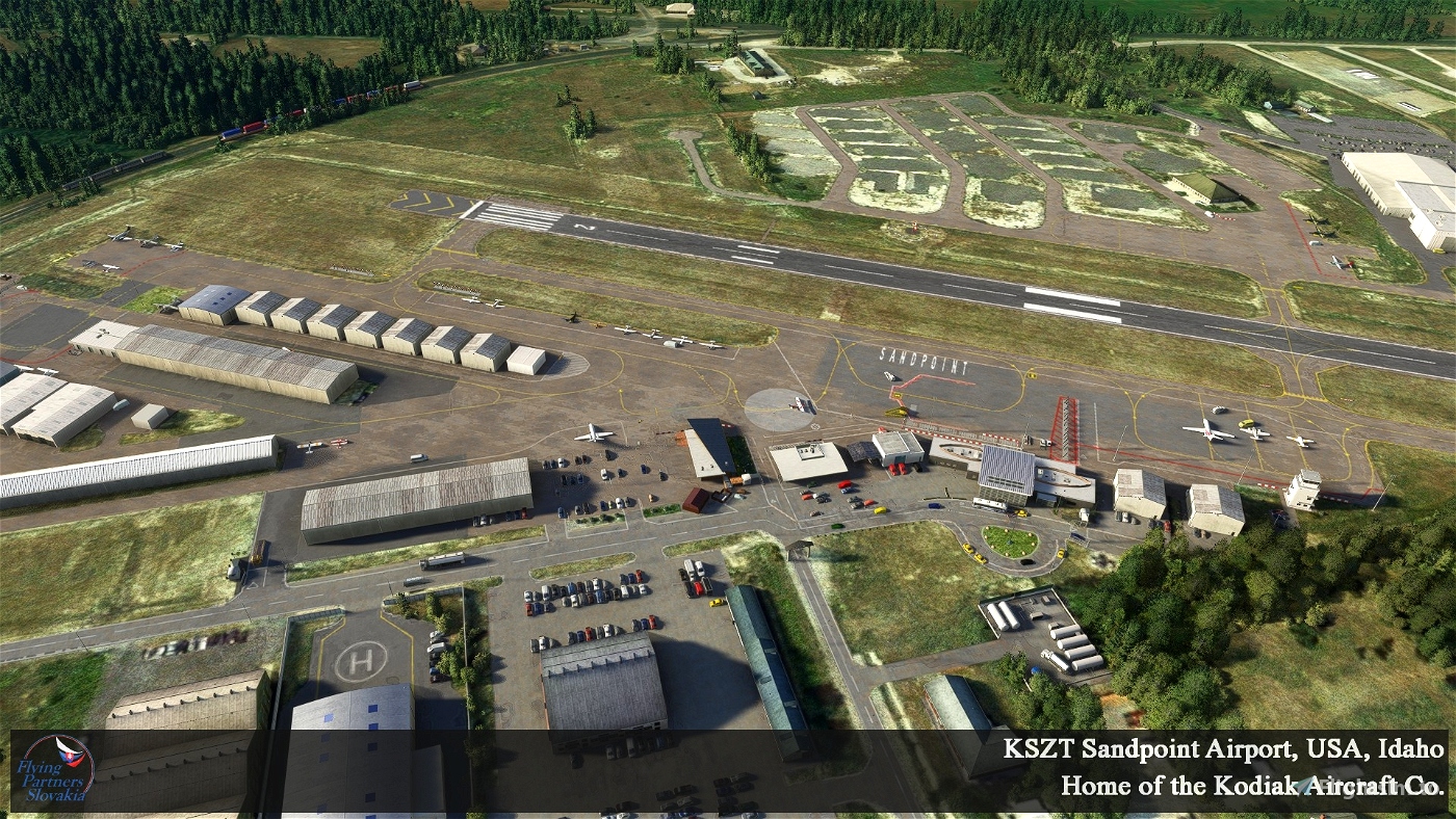
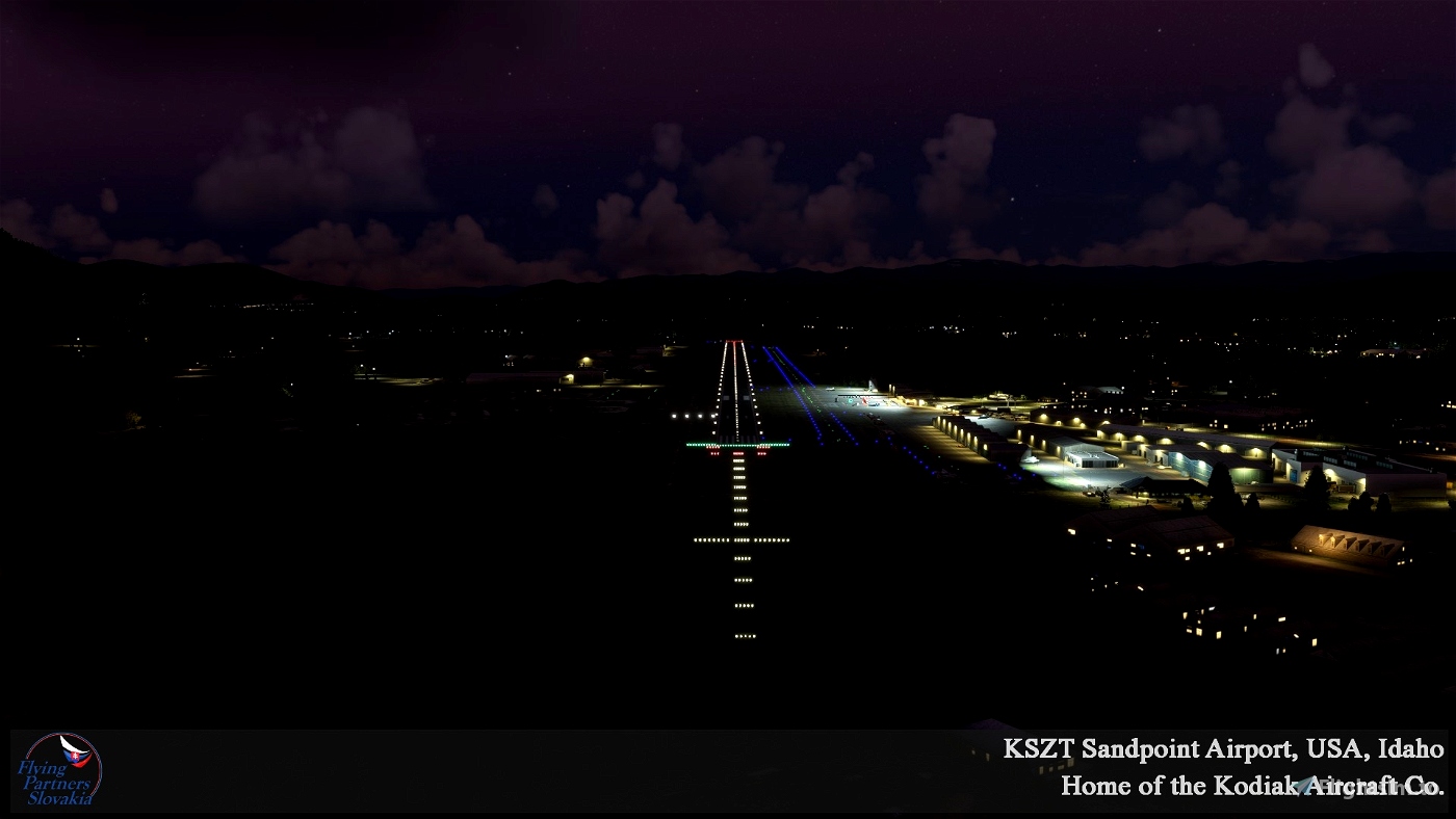
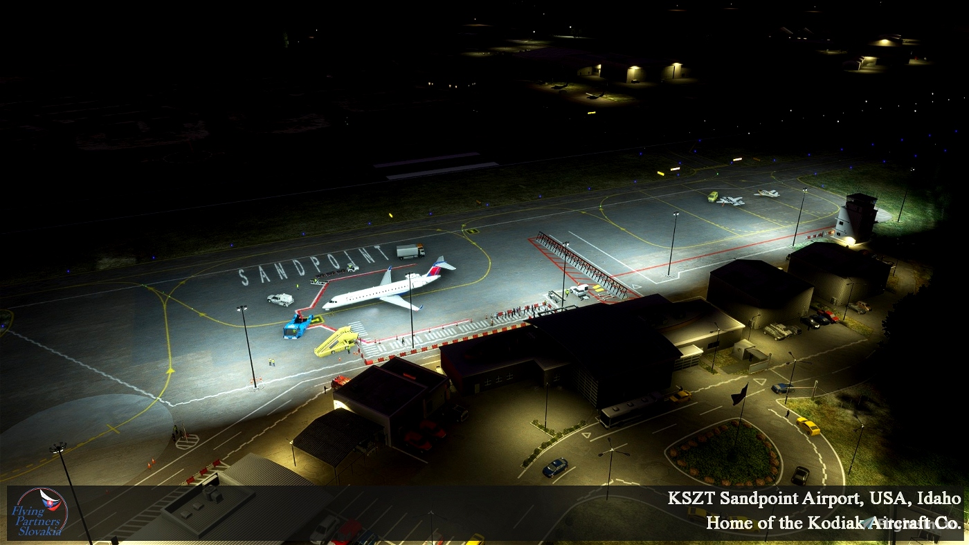
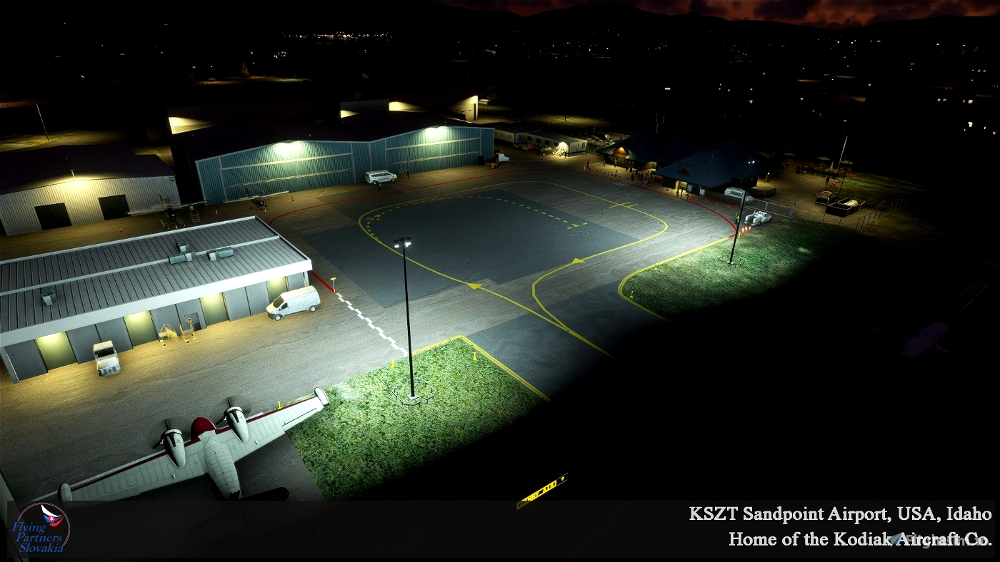
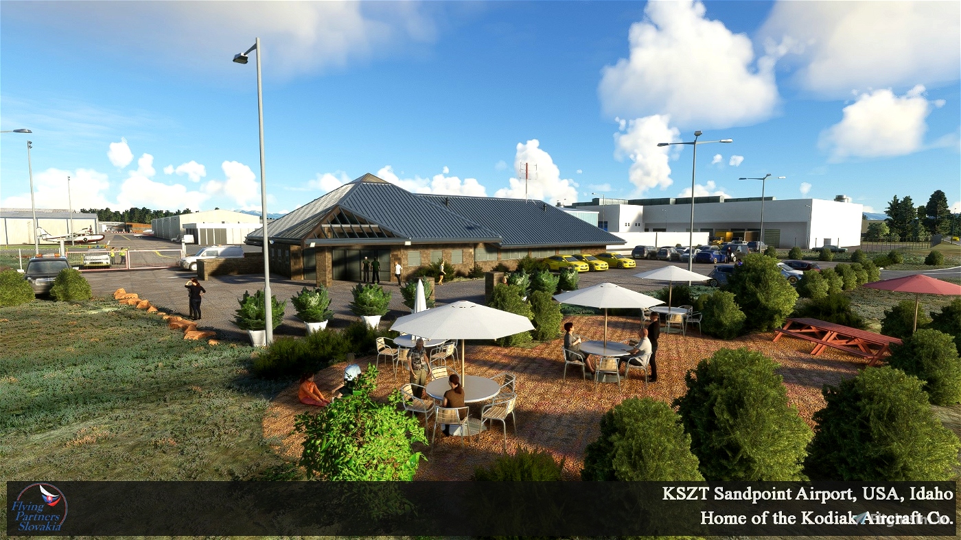
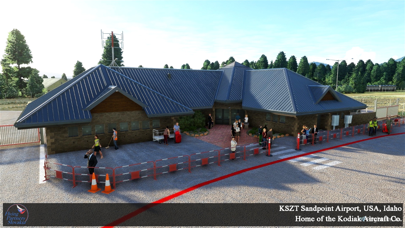
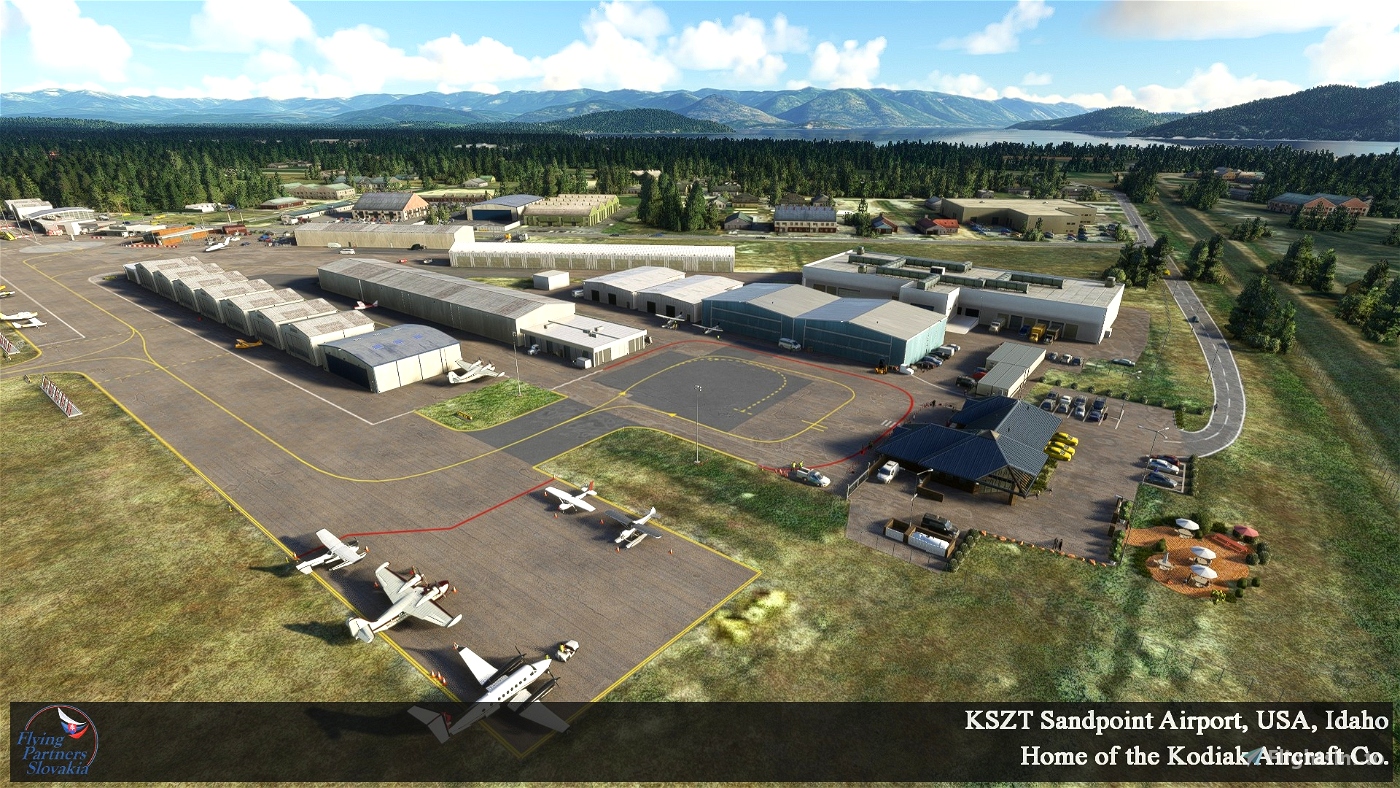
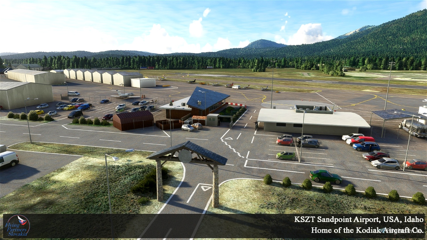
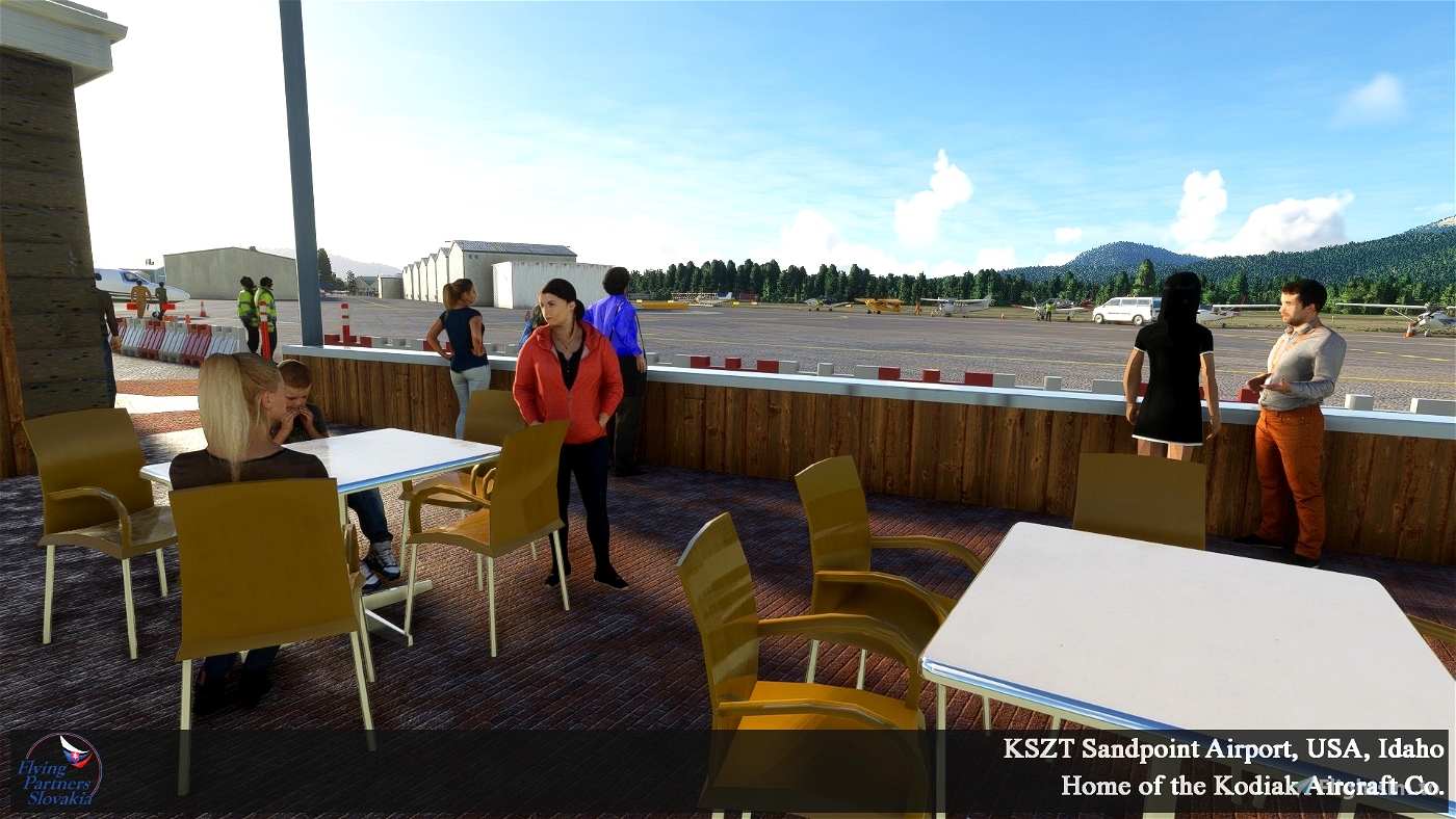
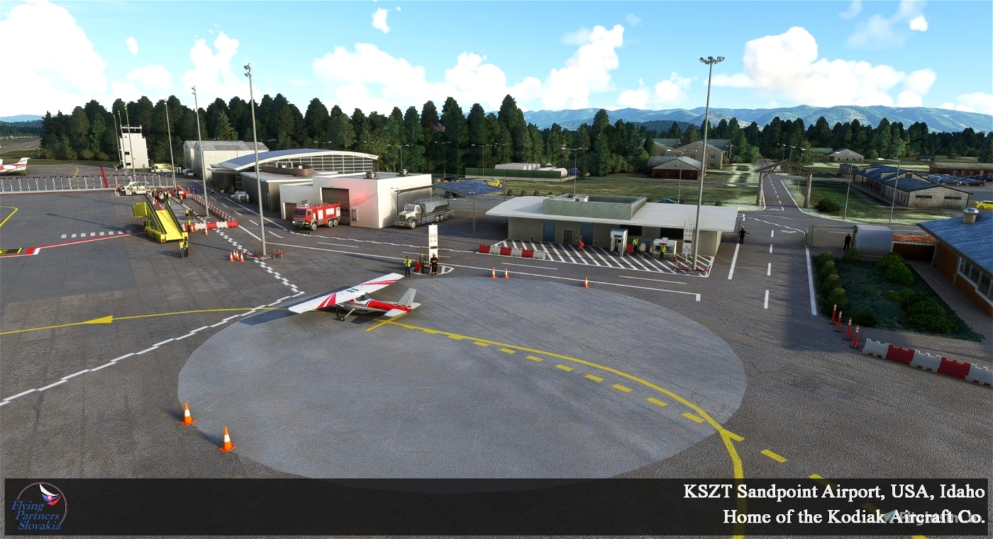
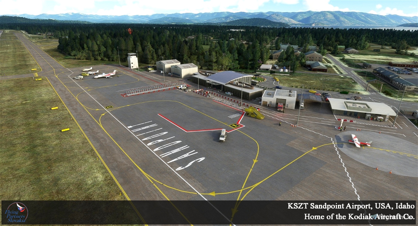
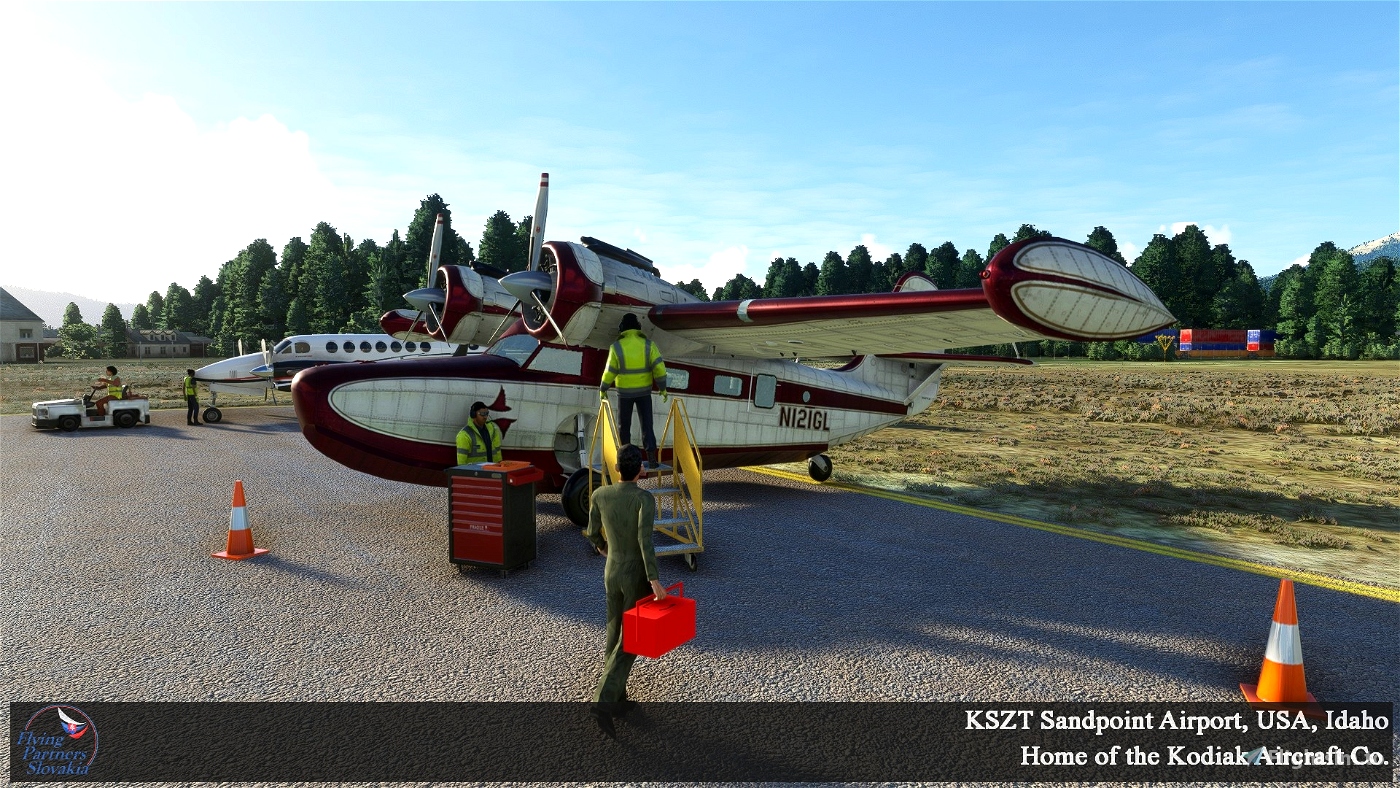
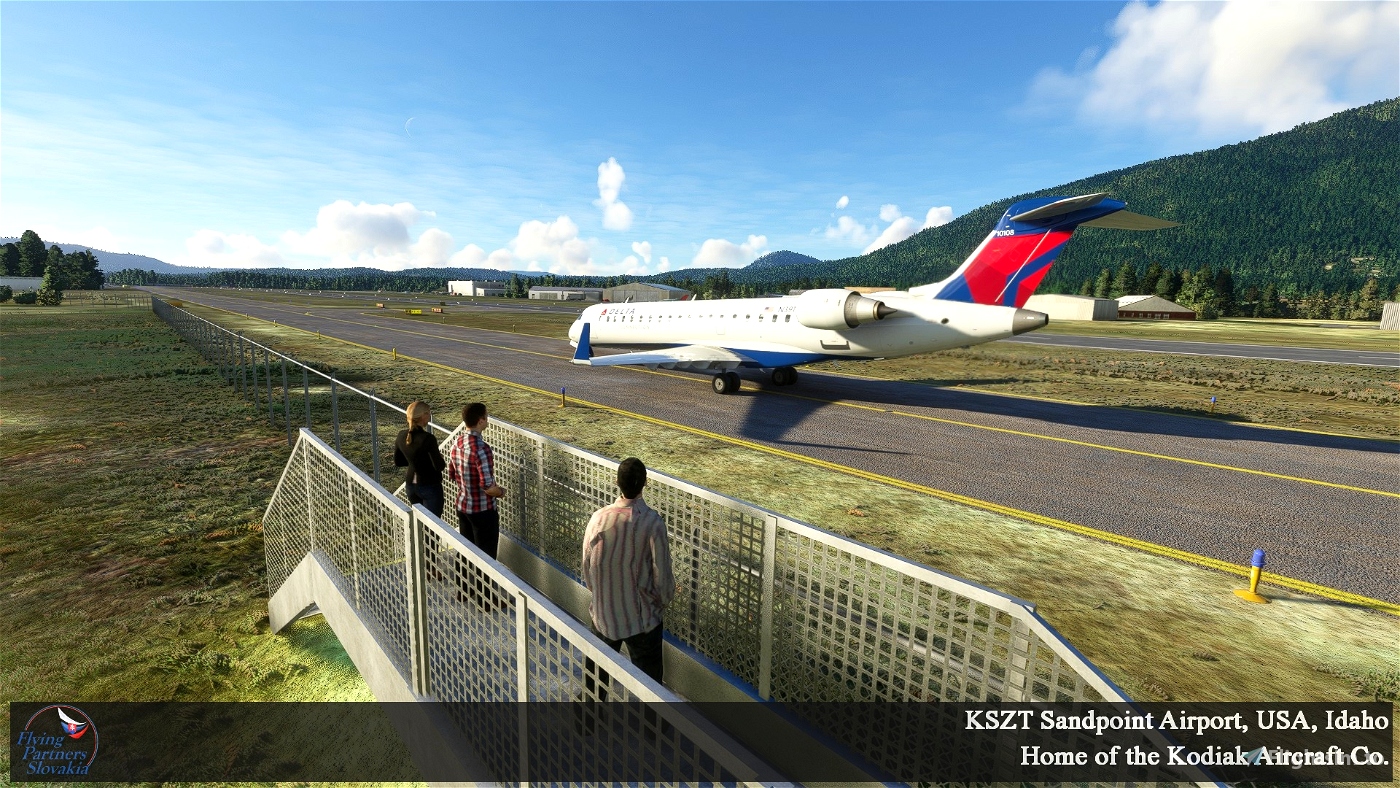
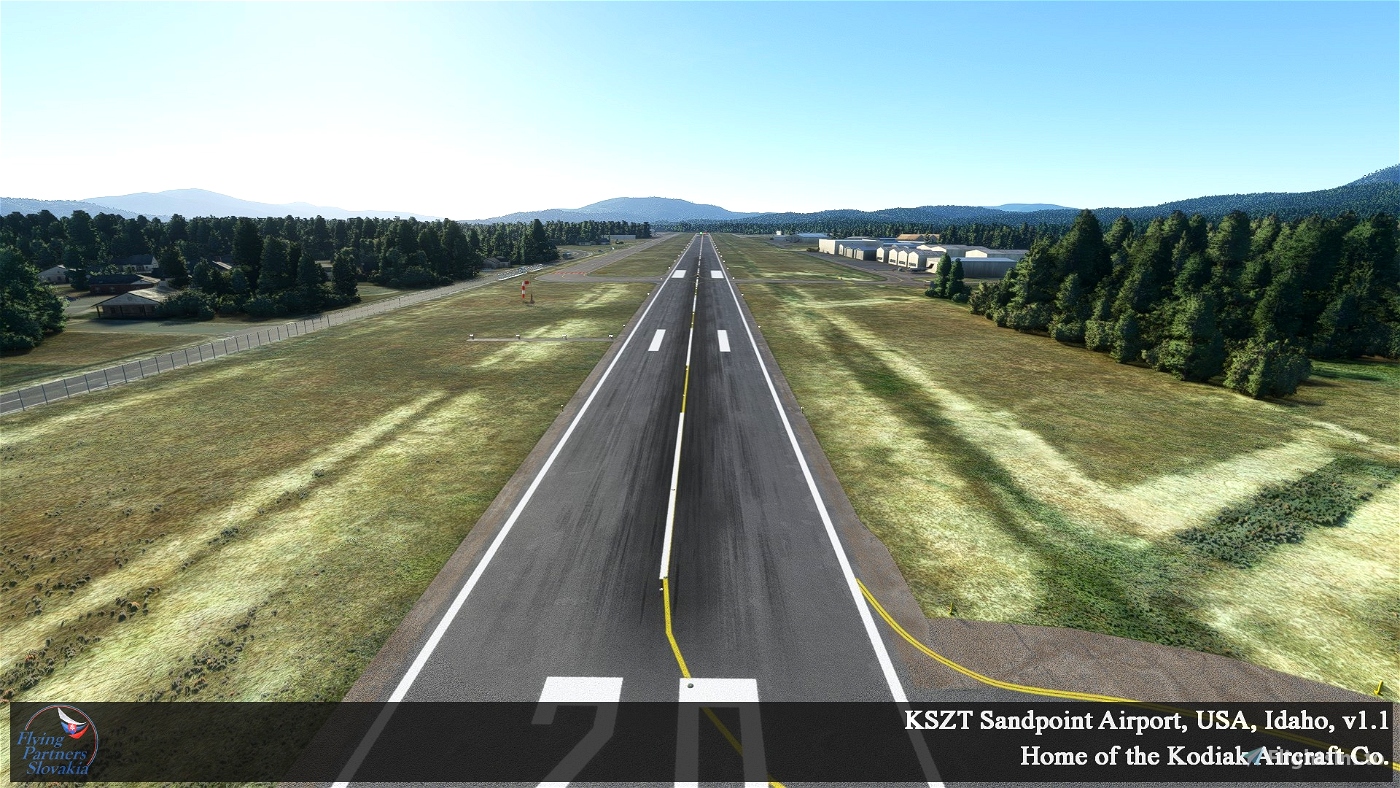
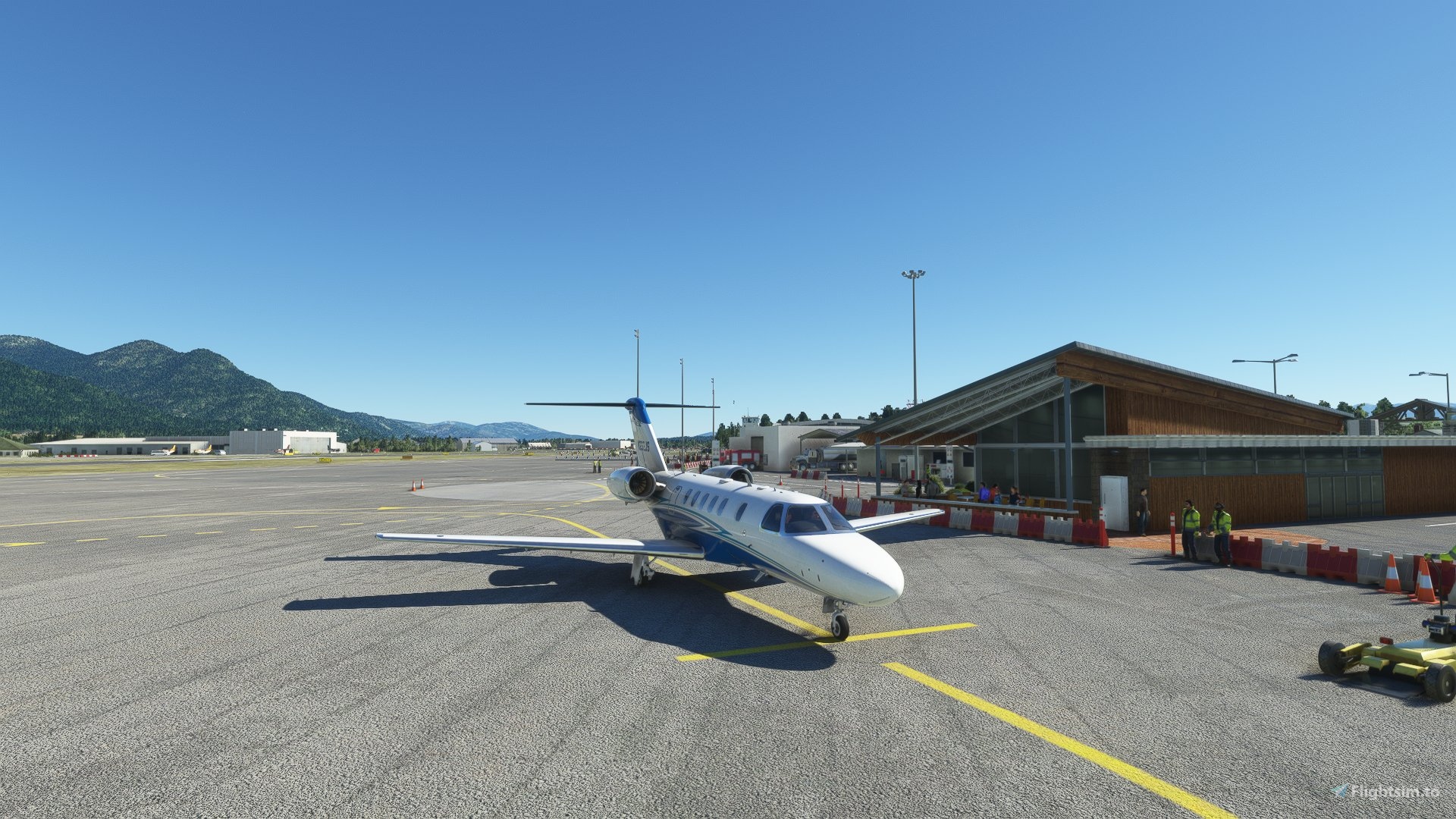
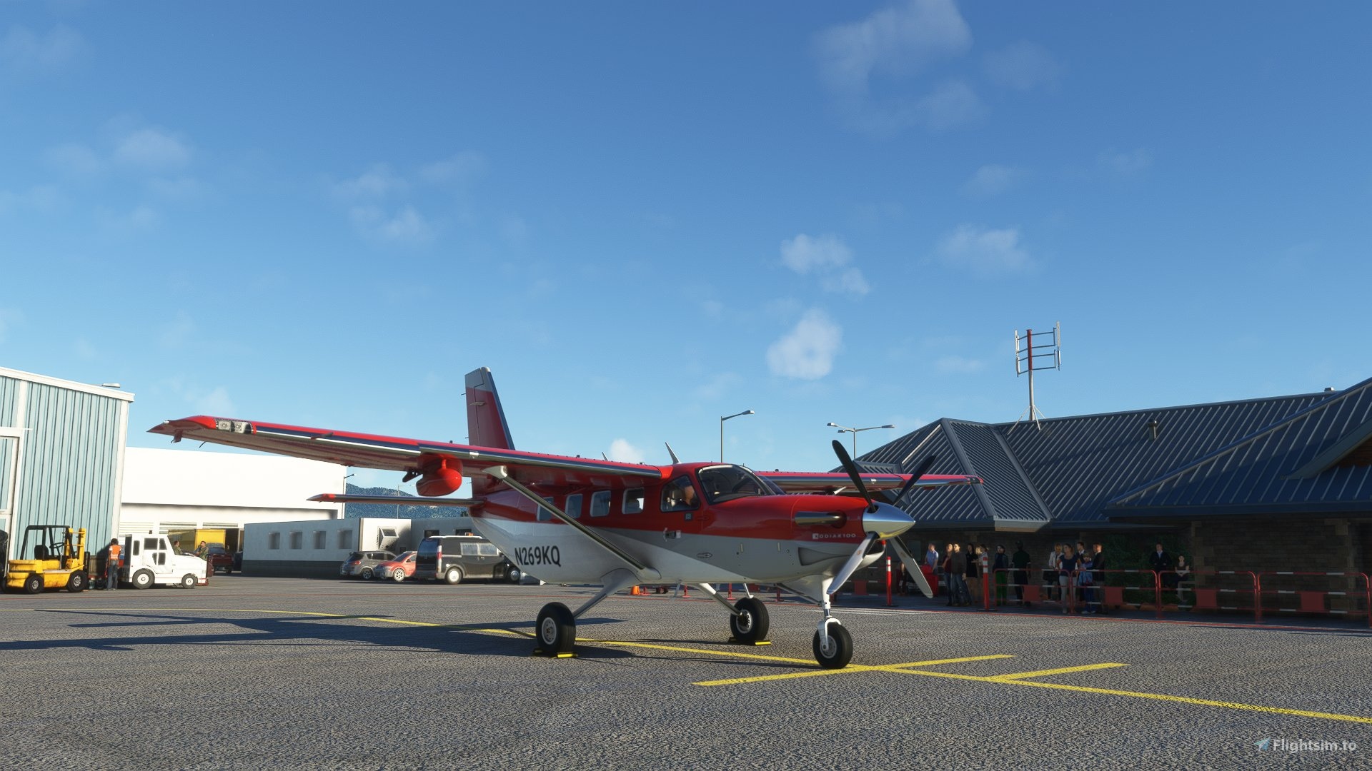
The aim of this project was to create the most reliable scenery of Sandpoint Airport (Idaho - USA) near town Sandpoint using only 3D objects from the Asobo / Microsoft library. But the airport has longer and wider RWY, wider Taxiways, Tower and Ground frequencies, Terminal and one fictional airline called "Jenny Air" with a terminal and stands. Now is possible to operate the CRJ-500/700 from this airport safely. To complete the atmosphere, ware used objects from Daves 3D people library with the written consent of the author. You can find his and library name in the "Installation" section. Many thanks to him for his work. Paragraph "Acknowledgments".
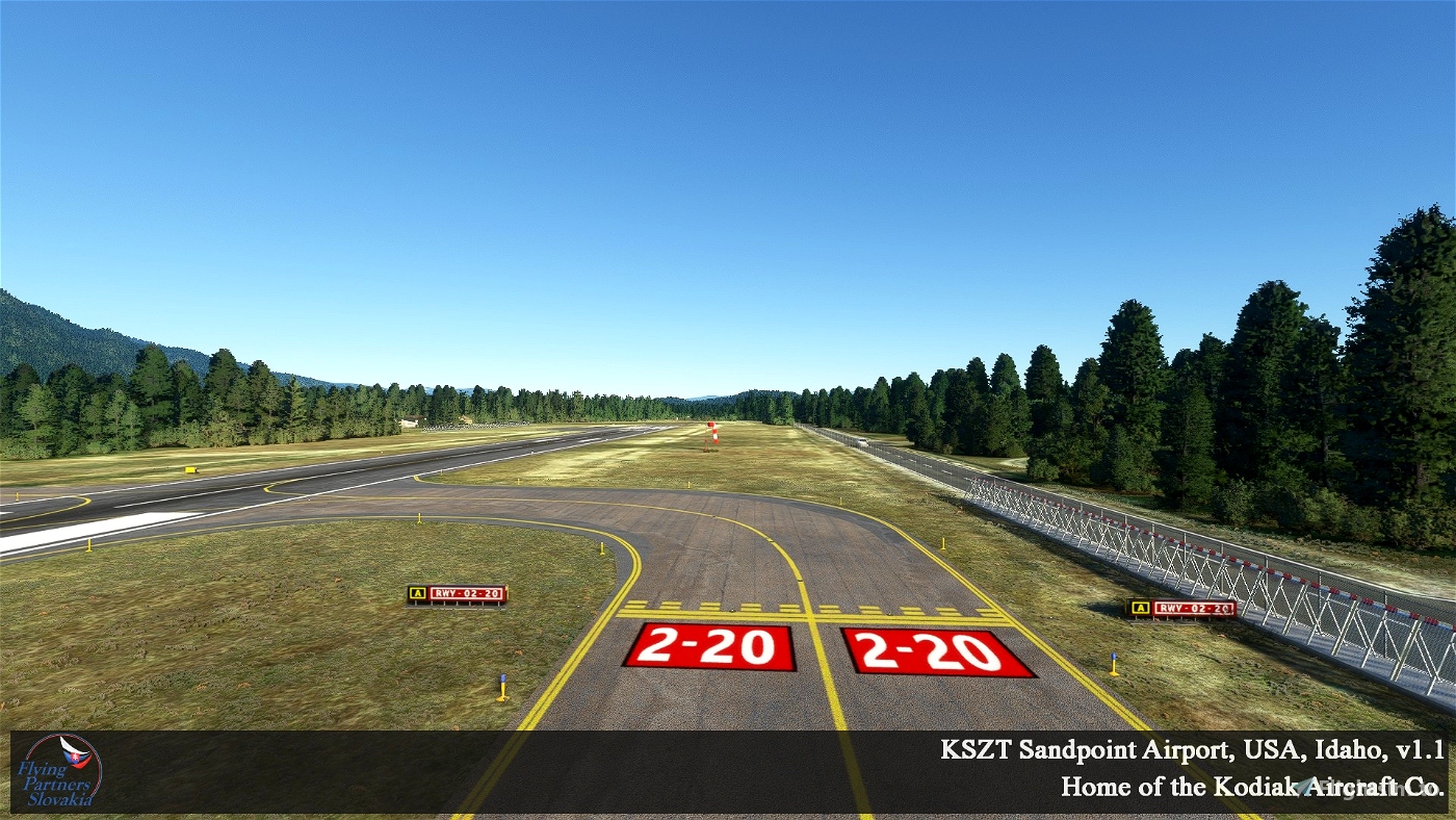
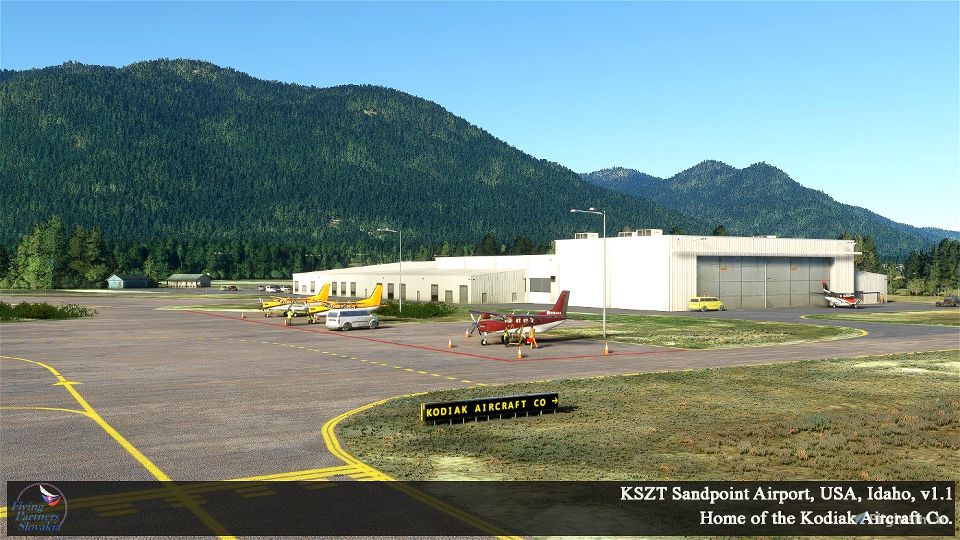
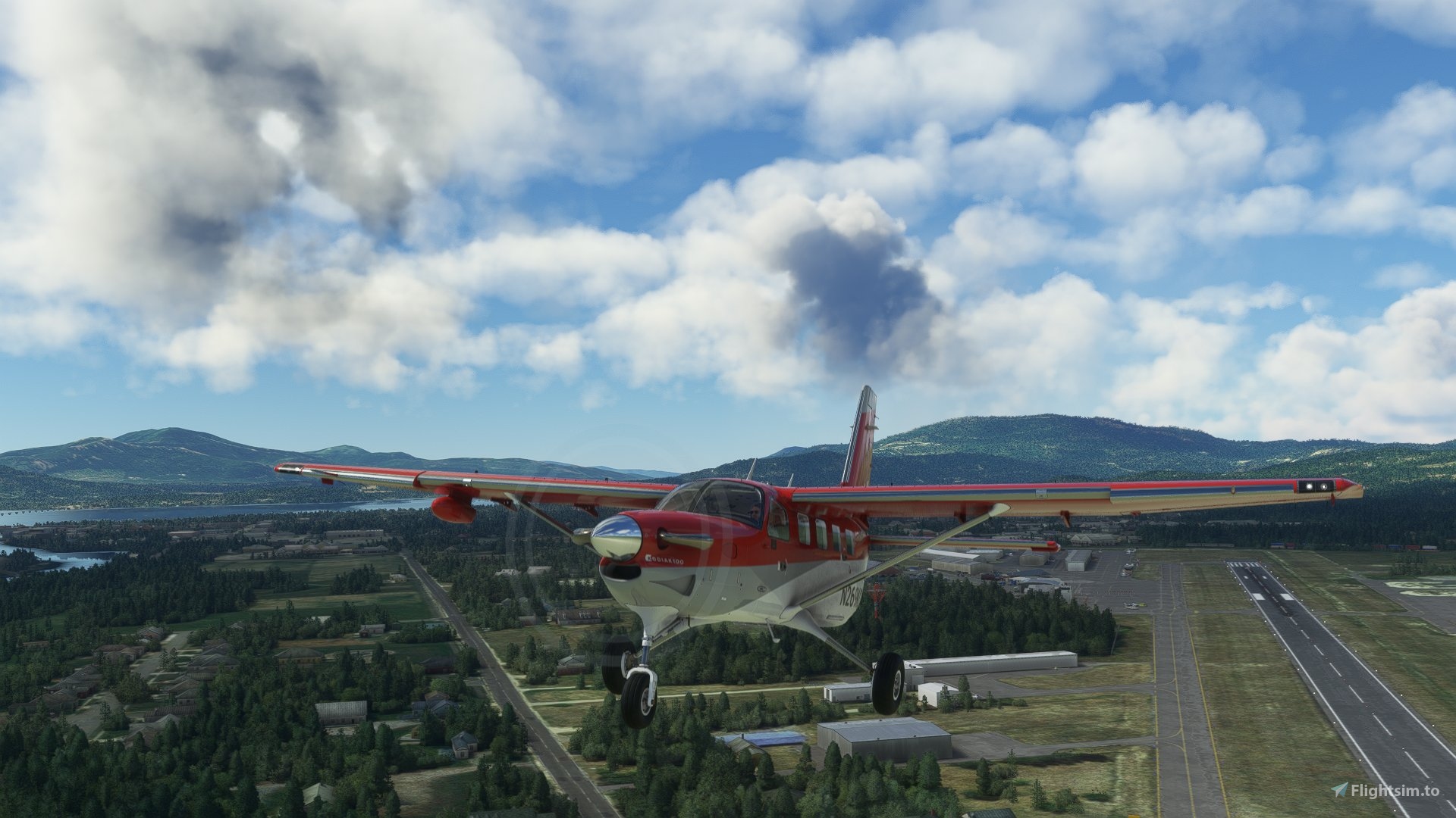
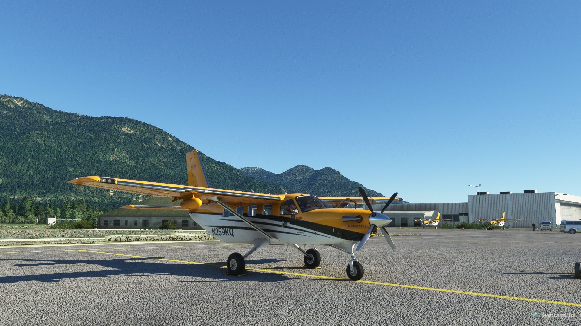
Version 1.1 includes: fixed runway markings, rubberized runway 02/20, in front of the hangar and at the Kodiak Aircraft Company stands, the real Kodiaks are already standing there, Lake Pend Oreille railway bridge and some roads around the airport.
Scenery description:
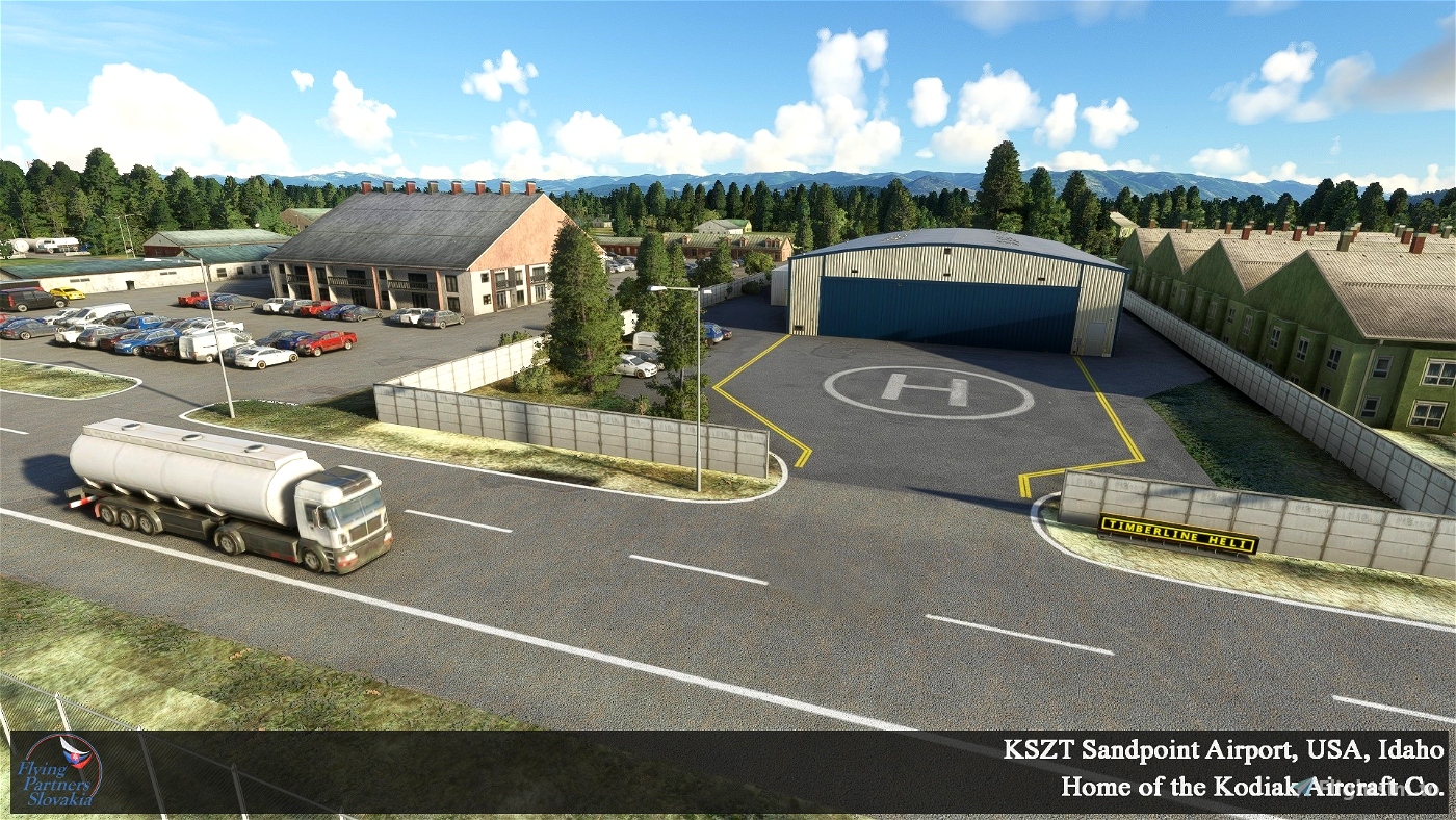
The basis of this scenery is an ortho photo map. It has been retouched in color to better fit the Bing map used in the MSFS. The scenery covers the airport area. Also my custom textures ware used.
Installation:
To view all objects, please at first download, unzip and copy to the “Community” folder in your MSFS:
1.) Dave's 3D People Library: https://flightsim.to/file/5452/dave-s-3d-people-library
Installation procedure:
1.) Delete, or backup the old version 1.0 of the airport from the Community folder.
2.) Unzip the file: „FP_KSZT_Sandpoint-airport_v1.1“ for example to the desktop.
3.) Folders: „fps-kszt-airport“ and „fps-kszt-airport-ortho“ copy to the "Community" folder in your MSFS.
Enjoy flying over Sandpoint, IDAHO.
I highly recommend:
to download and install to Community folder free aircraft model "Grumman Goose G21A Redux II"
here: https://flightsim.to/file/19718/grumman-goose-g21a-redux-ii
And if you want to buy: "Kodiak 100 Series II"
here: https://simworksstudios.com/kodiak-100-wheels-for-msfs.html
Acknowledgments:
Dave's 3D People Library - BadMed ( great models of people )
Thank you very much.
Terms of use:
The work published in this archive is subject to all legal standards on copyright protection. It is forbidden to modify, further distribute and use the work for commercial purposes without the knowledge of the authors and their written consent. The authors disclaim any responsibility for any problems arising after the installation or use of this scenario. The scenery has been tested. Due to lack of time, we provide only limited support. Thank you for understanding.
authors: Martin Duris ( maverick60 ) - Ortho texture, RWY, TAXI, Apron, Placement of objects.
contact: [email protected]
Airport description:
Sandpoint Airport (ICAO: KSZT, FAA LID: SZT) is a county-owned public-use airport in the northwest United States, located two nautical miles (4 km) north of the central business district of Sandpoint in Bonner County, Idaho. The airport is also known as Dave Wall Field.
Although most U.S. airports use the same three-letter location identifier for the FAA and IATA, this airport is assigned SZT by the FAA but has no designation from the IATA.
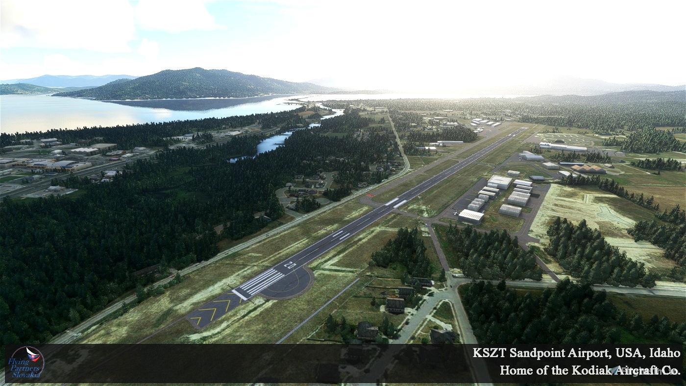
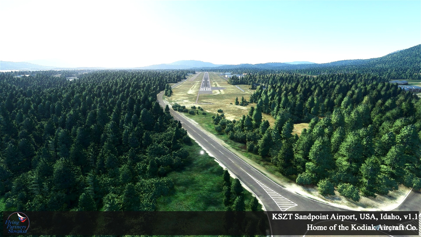
Sandpoint Airport covers an area of 104 acres (42 ha) at an elevation of 2,131 feet (650 m) above mean sea level. It has one asphalt paved runway designated 2/20 which measures 5,501 by 75 feet (1,677 by 23 m).
For the 12-month period ending April 28, 2006, the airport had 29,900 aircraft operations, an average of 81 per day: 99% general aviation and 1% air taxi. At that time there were 85 aircraft based at this airport: 84% single-engine, 13% multi-engine, 2% helicopter and 1% jet.
source: www.wikipedia.org
Technical informations of this modified airport:
• Name: Sandpoint Airport
• Directional sign: KSZT
• Airport type: county-owned public-use airport
• Permitted type of air traffic: Non-scheduled traffic
• Public / non-public: Public airport
• IFR / VFR: IFR / VFR
• Types of aircraft: Airplanes, Gliders, Ultralight aircraft, Helicopters, Jets ( CRJ 550/700 )
• GPS position: 48-17-58.3620N / 116-33-36.4860W
48-17.972700N / 116-33.608100W
48.2995450 / -116.5601350 (estimated)
• Altitude of the airport: 2131 ft / 650 m (estimated)
• INFO / TWR / APP: 134,90 / 135.10 / -
• RWY: 02 / 20
• Dimensions: 5577 x 82 ft / 1700 x 25 m
• Surface: Asphalt
History:
For information please visit: https://downtownsandpoint.com/sandpoint-history/
Maps:
For information please open the "maps" folder in this package.

 FlyingPartnersSK


1 months ago
1 months ago
FlyingPartnersSK
walterbeech
4 months ago
4 months ago
FlyingPartnersSK
adomeitus
a) can not be found on the Scenery map
b) can not be found via search bar.
Maybe it is because that underscores in the name? And check if coordinates is entered, so it can go to Scenery map.
7 months ago
Junglist
Great place, thank you for bringing it up to such a hight quality!
11 months ago
Hello. Thank you very much for your kind words. Martin, FPS
10 months ago
FlyingPartnersSK
Junglist
A quick question: Is the ortho still needed since the second USA world update?
2 years ago
Hello. You can try to delete folder "fps-kszt-airport-ortho" from your community and check it in MSFS. Martin, FPS
2 years ago
FlyingPartnersSK
THEOLI4D
Awesome!!!!!!!
2 years ago
Thanks a lot :) Martin, FPS
2 years ago
FlyingPartnersSK
agvirtus85
Thank you for the amazing work! Really enjoyed flying out of here with the SWS Kodiak 100.
2 years ago
Hello. Thank you very much. Yeh, Kodiak is also my favorites addons :) Martin, FPS
2 years ago
FlyingPartnersSK
RotateDesign
Fantastic airport and what a fun approach. Works perfectly with SU9/WU10.
2 years ago
Hello. I am really glad that you like this scenery :) Martin
2 years ago
FlyingPartnersSK
robhaynes82
Very nice, thank you.
2 years ago
fStopper
Fantastic Scenery on payware level.
2 years ago
Thank you very much ;)
2 years ago
FlyingPartnersSK
Boeingman
Nice work on the scenery! I used to have my plane based there and really enjoyed flying around the area. Getting to fly around in MSFS really makes me feel nostalgic. I appreciate your work.
2 years ago
Thank you very much. I'm glad you like the scenery. You don't even know how much I would like to visit Sandpoint in person;) At least so virtual :) Martin, FPS
2 years ago
FlyingPartnersSK
utexgrad
this a great job on this scenery, love to fly this part of Idaho. I've put in request for up by Priest lake, Coure d'Alane,Cavenaugh Bay, Haden lake and all the float plane docks up there. I've been trying to learn how to do this on my own, google earth has some great data up there I just haven't figured out the SDK and how to make it work.
Are you going to do anymore Idaho scenery ?
2 years ago
Hello.
Thank you very much for your positive feedback. Now we are focus for payware sceneries of Slovakia airports. Anyway we would like to make some US airports including Priest lake - Cavanaugh Bay airport. If we want to create quality project is neccesary to have quality photos of airport buildings. And this is problem. We are from Slovakia. If it were possible to get photos of airports legally, that would be great.
Martin, FPS
2 years ago
FlyingPartnersSK
mogul
I don't believe Rwy 02 has an approach light system (ALS)?
The airport charts only show runway lights, REIL, and PAPI.
https://airportdocs.iflightplanner.com/AFD/211202/nw_72.pdf
2 years ago
I greet you too;) Of course I know about that. I always study the original documentation for my projects first. But I wanted to have PAPI4, a longer and wider RWY and Taxiways. Also approach lights and so on. For this reason, I also wrote it in the readme / manual / that it is partly a fictive airport. Martin, FPS
2 years ago
FlyingPartnersSK
mabrodb
Stunning beautiful airport.Its going to be one off my favorits.Like what you have created.Big thank you from the Netherlands.
2 years ago
Greetings to Netherland. Thank you very much. I appreciate it. Martin, FPS
2 years ago
FlyingPartnersSK
Andre64
great airport. but I notice a slight mistake. the RWY is 20 but the signs are pointing to 02-24. is that a mistake?
2 years ago
Hello. Thank you very much for recognition. Ohh, sorry. It is my mistake. I didn't notice it. Thank you for pointing me. Martin, FPS
2 years ago
FlyingPartnersSK
hvh9001