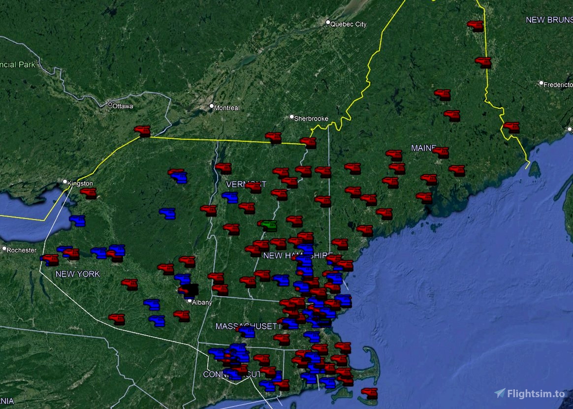

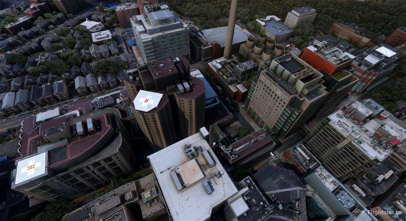
This project aims to model and place most/many of the helipads that currently exist within the confines of ZBW (Boston Air Route Traffic Control Center)'s airspace, the current version includes 153 pads in 7 states (Massachusetts, Connecticut, Maine, New Hampshire, New York, Rhode Island, and Vermont), no more states are planned for this pack, however some additions/changes may be made in the future.
A couple of notes for those interested in downloading the scenery.
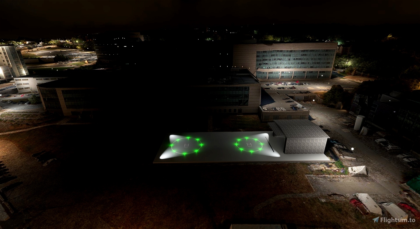
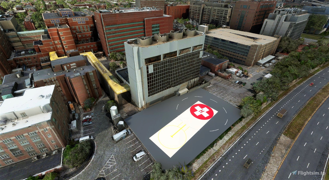
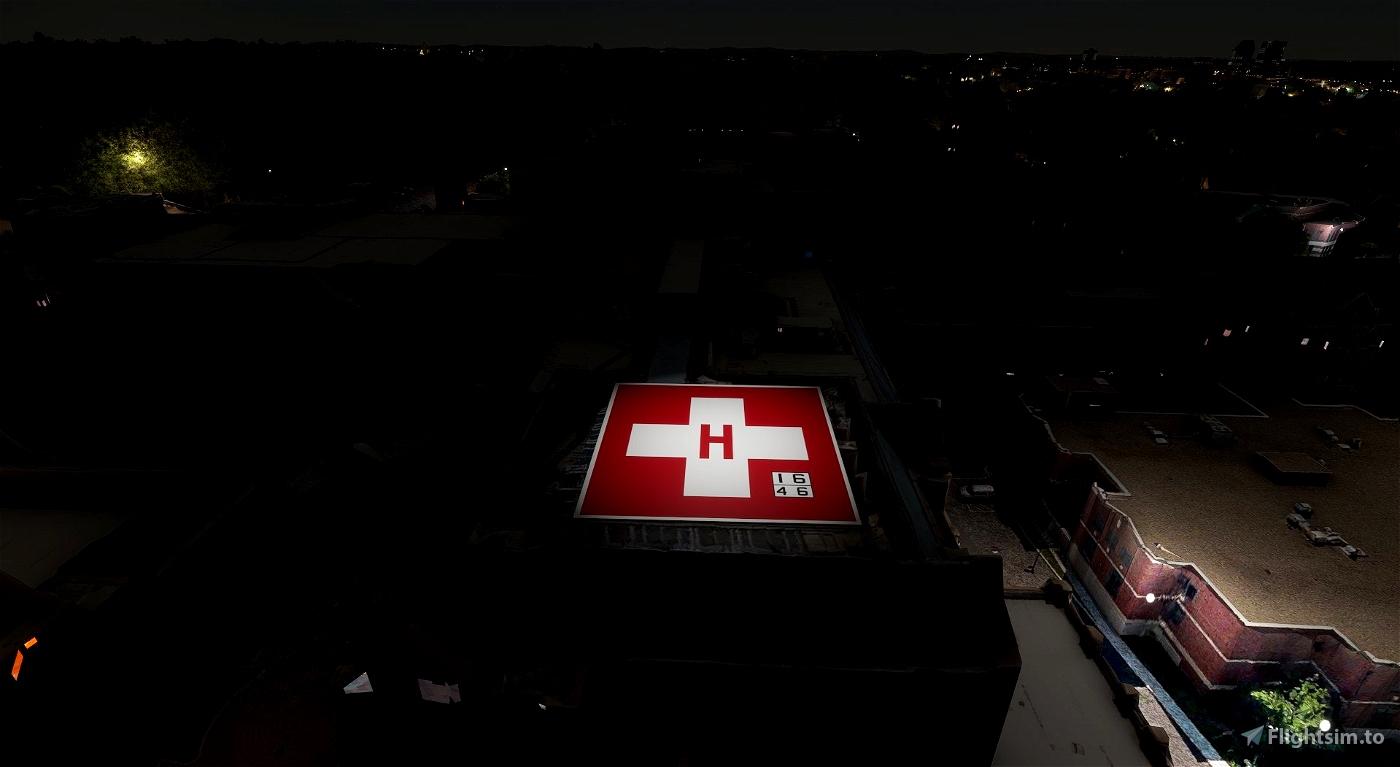
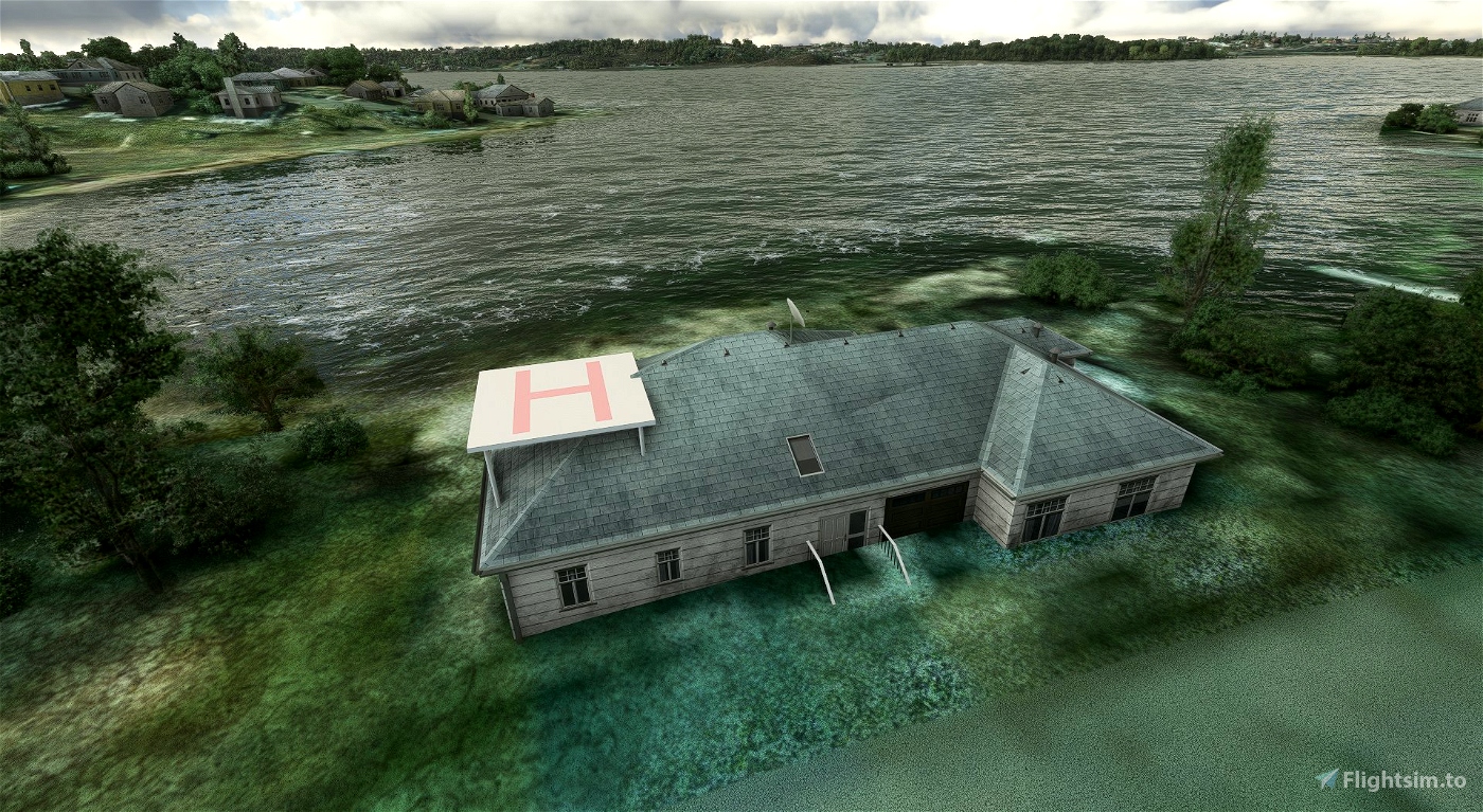
- These models are purposely not high fidelity (no fencing, walkways, safety netting/panels, etc), as my goal is not to spend 10 hours on 1 pad, and with the amount of pads I'd like to have in the final pack high-poly/texture models would make the total size of the addon insane.
- There are 4 things prioritized;
- Being more visible than the background satellite imagery.
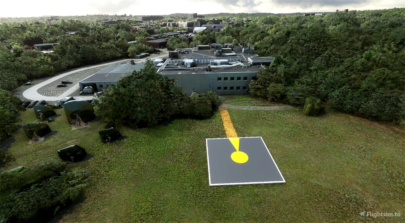
- Being a flat, hard surface to land on (should match the size of the pad)
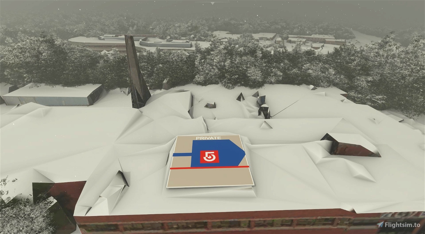
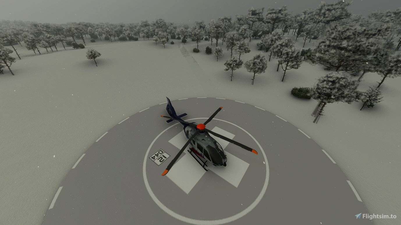
- Not accumulating snow - very important in New England
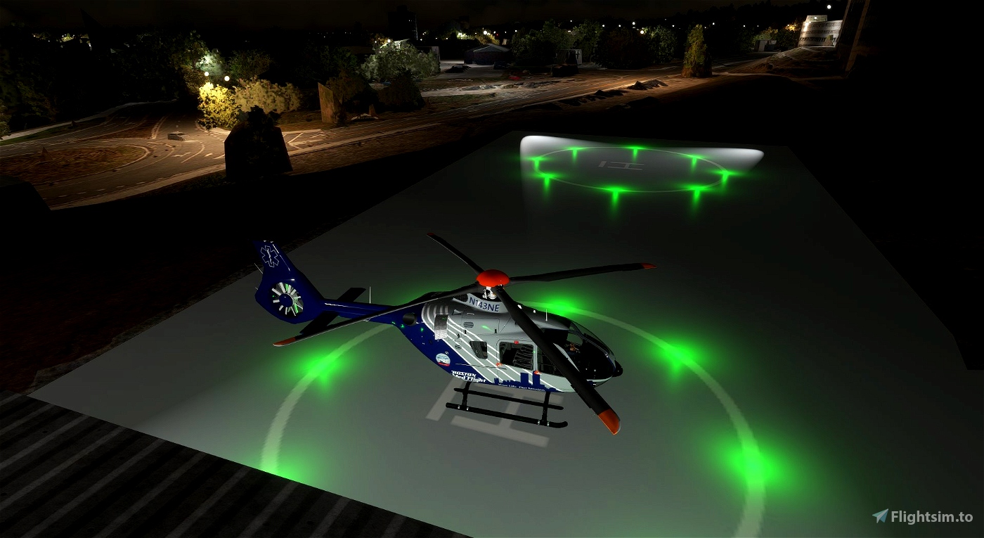
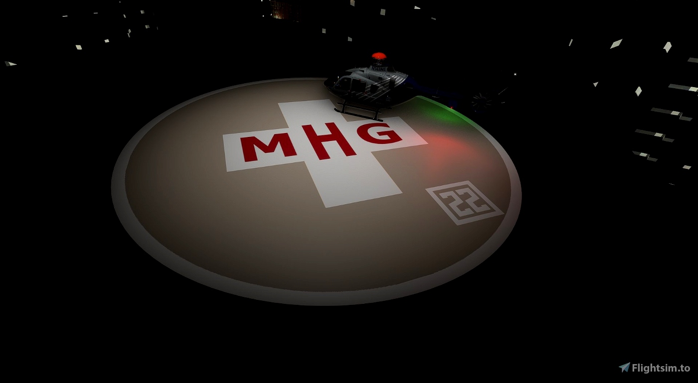
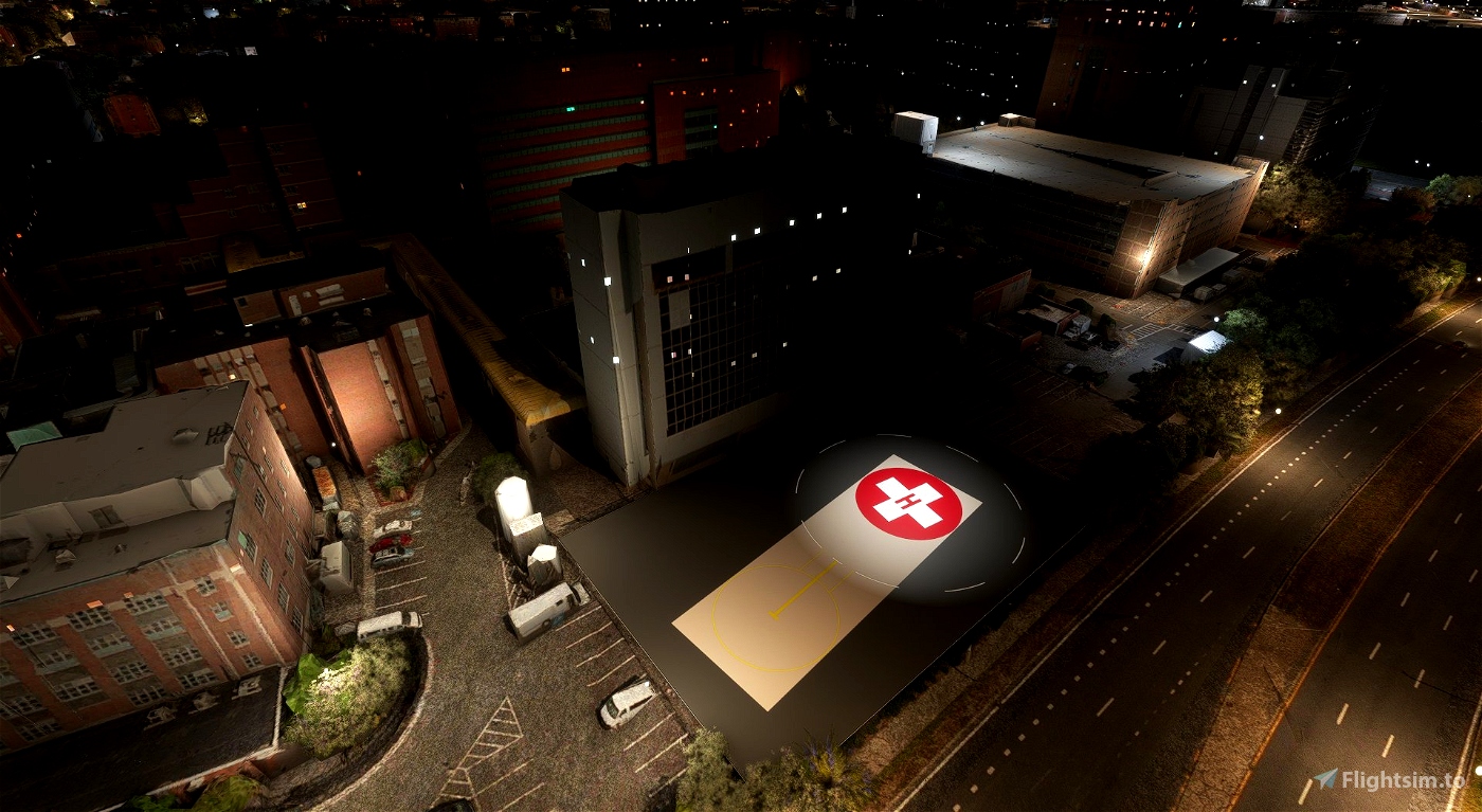
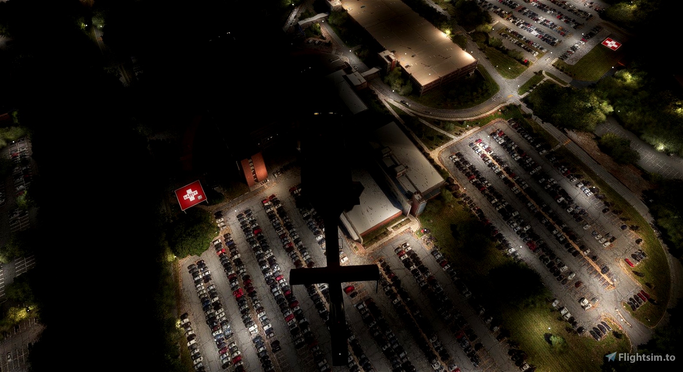
- When applicable being lit (all medical pads are lit, about half of the civilian ones are.
- These pads were specifically developed and tested using photogrammetry set to on, I have not done much testing with it off, but if you normally fly with it off it is very likely pads will be floating above buildings; if a pad is hovering over a building I do not plan to fix it, however if a pad is covered by a building please contact me with the settings you are running (ultra, low end, photogrammetry on/off, etc), and I will attempt to fix it for the next update.
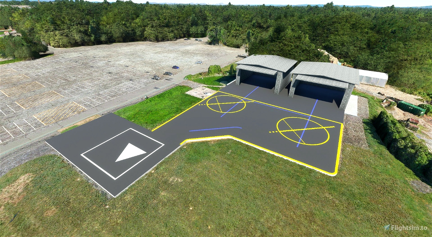
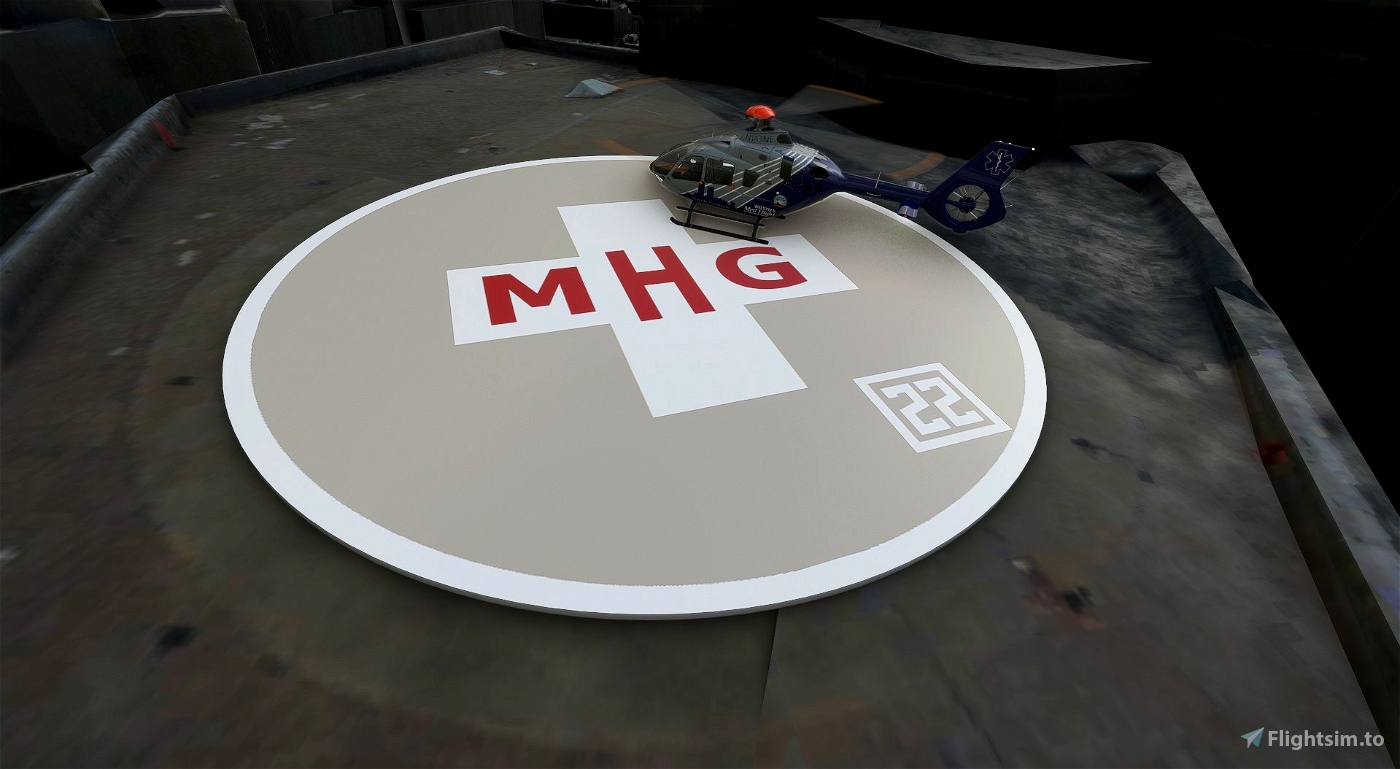
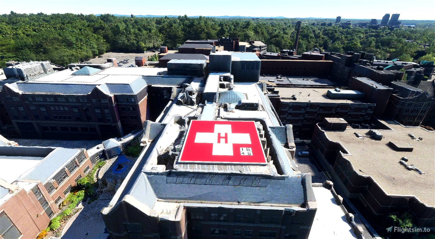
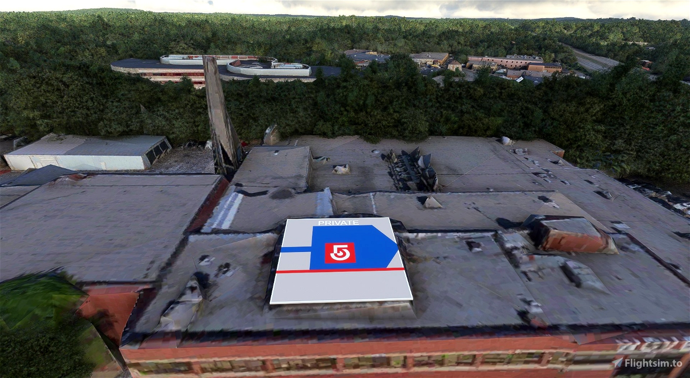
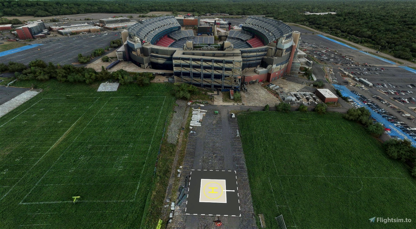
- There are a few pads (1MA2, 2NH6, 45NY, MA68 and NH82) with some extra detailing as they are bigger/heliports.
- All pads are marked in a .kmz file in the zip folder, there is also a .csv file you can import user waypoints for littlnavmap, and all but 1 of them (MA62) are also listed on Volanta. As of v0.0.15 they also appear on the World Map and GPS as intersections (Type in the ICAO in the searchbox). - You still cannot spawn on the ground at any of the pads, I plan to add the ability to do this, but it is a little more difficult than I expected, will be in the update following v0.1.0.
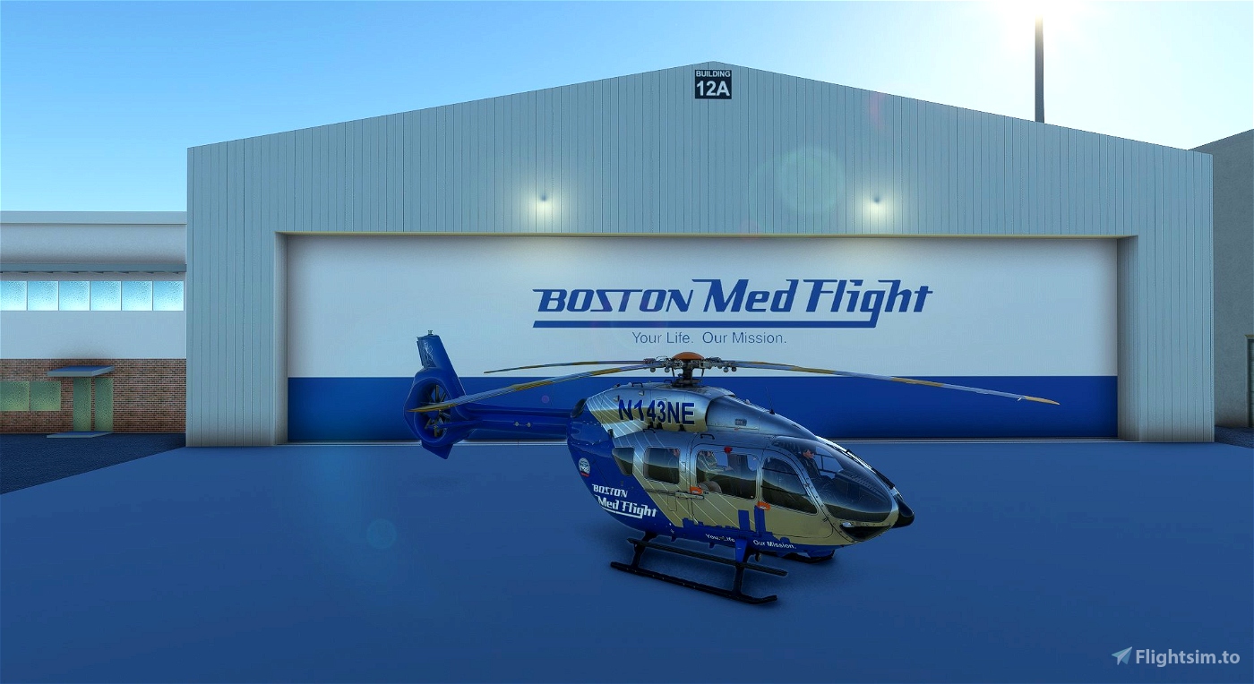
- As of v0.1.1 you can now spawn at 1MA2, NH82, and the Boston Medflight Hangar at KBED (Spawn ICAO: ZBW1), I will likely add a few more spawnable 'airports' in future updates, but it will never include all pads.
- As of v0.1.1 Hangars at KBED and NH82 are animated, and automatically open in the morning, and close in the evening, you can also manually open them if you are in the HPG EC135 by hiding the cyclic.
Known Issues:
- Many pads will be floating, either over the ground or building they are meant to be attached to, this may be due to 1 of many issues, primarily the fact that I cannot remove grass - and it will stick through the reasonably thin pads - and that different scenery settings will adjust building heights and details.
- The pads around Boston were modeled and placed at ultra settings, some others were placed on low-end settings.
- Low quality model - not really an issue, this was a design choice, since just with 1 state there are over 40 pads higher fidelity models will be resource intensive.
- Added March 18th: MA68 has no lights at night, this was fixed in v0.0.15.
- Added March 29th: Many Massachusits pads no longer appear, this was a compiler error, was fixed in v0.0.14.
- Changed June 30th: Cannot spawn at some heliports/helipads; In v0.1.1 you can now spawn at 1MA2, NH82, and the Boston Medflight Hangar at KBED (Spawn ICAO: ZBW1), I will likely add a few more spawnable 'airports' in future updates, but it will never include all pads.
Potential/Likely Issues (Please report such issues):
- Pads partially/totally covered by buildings. - due to differing scenery settings the details or height of buildings may vary, if you notice pads are covered/merged into buildings please let me know (with your current settings).
- Grass sticking through pads - It is not unlikely there will be grass sticking through some of these pads, if you notice this please let me know (with your current settings).
- Pads 'popping' into view - I think I corrected this issue, but if you notice you have to be exceptionally close (less than .25nm or a few thousand feet) for a pad to appear please let me know.
Additional Notes:
- The states of Connecticut, and New York are split between Boston and New York ARTCCs, only the parts of the sates covered by Boston are/will be includeded.
- KMZ and CSV file included for use with Google Earth, and Little Nav Map respectively, LNM file updated in v0.1.1 to be visible from greater height (100nm).
Changelog:
- v0.0.12 - Initial release, includes 46 helipads in the state of Massachusetts.
- v0.0.13 - First major update, adds 23 helipads (69 total) in the states of Connecticut, and Rhode Island.
- v0.0.14 - Re-added pads accidentally removed in Massachusetts caused by a compiler error in v.13.
- v0.0.15 - Second major update, adds 39 helipads (108 total) in the states of New Hampshire, and Vermont, added intersections to World Map and GPS for all pads.
- v0.1.0 - Third major update, adds 45 pads (153 total) in the states of New York and Maine.
- v0.1.1 - Fourth major update, adds higher detailed and animated hangars to KBED and NH82, as well as some spawnable pads and general fixes.
Any feedback is appreciated, either here or via email ([email protected]).


Idk if this is an abandoned project at this point but if you could make this mod compatible with enjoyitfly's Boston packs that would be great, and also Beth Irseal has a new helipad on their new building that is included in one of the packs, photos of it can be provided if needed, dunno if any of the final pad are online yet
10 months ago
Not abandoned per se, but have been too busy with work to work on this project at all, if I get to working on another version I'll try to take a look.
10 months ago
RazorFlies
BostonAvation492
can you please add the ability to spawn at VT36 - MCHV Helipad/UVM Med Center? I need it for simulations
2 years ago
I will look into potentially adding it for a future update
2 years ago
RazorFlies
btownley2598
After WUX many of the pads are clipping into buildings now
2 years ago
I noticed this as well, I did some flying around to find the ones that are, but want to be sure I find all (or at least most) of them first before pushing an update. If you have a list that may be helpful as well.
2 years ago
RazorFlies
BostonAvation492
I flew to 4ME9, and did not find a helipad there.
2 years ago
Have you seen other pads? If so are they on the ground or were they rooftop pads? What are your scenery settings? Do you have v0.1.0 as this was the first version to include Maine? I just checked and observe the pad in sim with all the global presets ( https://imgur.com/a/PrJv3G9 )
2 years ago
RazorFlies
pickafivestring
Just downloaded the newest update. Can't wait to give it a go tonight. One small suggestion. When I create a custom userpoint, I usually let it default to the LNM value of 250 miles, so it shows up on the map without having to zoom in so tight. I *think* LNM uses 125 miles (maybe 150 miles?) for the non-towered magenta airport symbols, and that's what I'd suggest as a minimum for the the userpoint helipad symbols. Being able to see the helipad symbols zoomed out to seeing roughly the entire state area, would make flight planning a bit easier, by eliminating the need to keep zooming in to find the helipad symbols. Again, great work!
2 years ago
Thanks, I'll do that for the next update, wasn't aware you could change it. Appreciate it.
2 years ago
RazorFlies
pickafivestring
Really am enjoying this. Wish someone would cover Los Angeles. Cheers.
2 years ago
jvortiz56
I downloaded and dragged it to "Community". I do not see the helipads show up on the world map. Did I do it wrong? If so, what is the PROPER installation procedure. The instructions are crap. I love the idea though since I do mock trauma scenarios in Vermont.
2 years ago
Hello, the description above clearly states the pads do not show up on the map, or the GPS.
There are 2 files included to help you find pads; the first is a kmz file which can be used with Google Earth, and the second is a csv file which can be imported into LittleNavMaps to find the pads. If you have copied the correct folder into the community folder the pads will appear in sim, but do not show up on the map or GPS. If you do not want to use either of these programs you can open the CSV file and input the ICAOs listed into Skyvector and it will show you their location(s).
2 years ago
RazorFlies
btownley2598
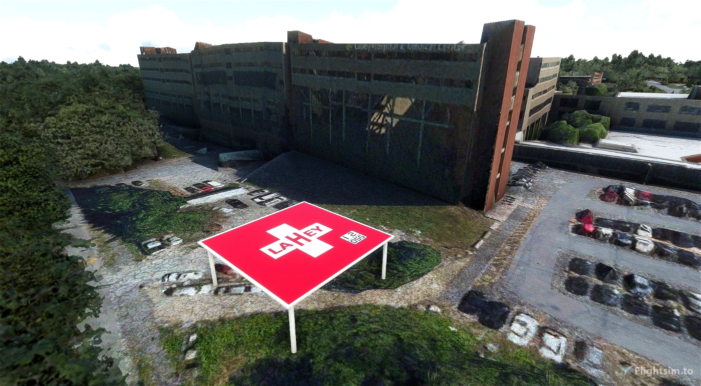
Loving This!!!!! It's a riot. The pic of the BWH ariel, the power plant in the pic I had worked @ back in the 80's......
2 years ago
RobM
Thank you for the great addition! I did notice that the latest version causes some helipads I saw in the previous version to be removed. I think I noticed that the Brigham and Woman's Hospital pad (MA39) and Boston Medical Center (0MA4) are back to the photogrammetry textures. Is this intentional? MGH (0MA1) is still modeled.
2 years ago
I'll have to take a look at that, it was not intentional.
2 years ago
RazorFlies
makattack
Razor,
This is a fantastic addon. I have been slowly learning how to use Blender, with the intent to do something like this, but no need now.
This is perfect for photogrammetry areas. For non-photogrammetry areas, maybe some generic hospital buildings with pads would be an option, to replace the autogen?
The Boston pads are really awesome, because you can use the helicopter route charts with them. I'd love to see all the areas that are covered by heli route charts done.
Again, FANTASTIC work!! Thank you so very much for doing this project.
2 years ago
Hey, thanks I don't have a lot of time in Blender either, but figured this would be a good project to learn on.
For the moment I am focusing on just getting the pads in the sim, if there is no generic building (like for the Hartford Hospital) I add a similar-ish building so the pad isn't floating like 50-100ft in the air. After I finish what I want there are some things I want to do, and figuring out a better method for non-photogrammetry areas is one of them, but I'll have to play that by ear when I finish placing the pads.
Yeah, the heli-routes are a bunch of fun.
Thanks, glad you enjoy it.
2 years ago
RazorFlies
pickafivestring
YES!!!!!!!
2 years ago
RobM
Great addon! I spent a couple hours trying it out around Boston last night (saw another H-135 Boston Medflight livery doing the same). I have been hoping someone was going to make these. If you're thinking about other states it would be awesome to see NH/ME/VT. Keep up the great work!
2 years ago
Thanks, very cool, depending on when it was that may have been me, I was flying around for a while on VATSIM. The plan is eventually to include all of Boston ARTCC's airspace (All of Maine, New Hampshire, Vermont, Massachusetts, Rhode Island, and parts of Connecticut and New York). I have mapped out RI and CT to start working on those next, but have not decided which state I'll move on to go after that. No idea on a timeline, depends on my free-time.
2 years ago
RazorFlies
Medic_Ted
Looks pretty sweet. Going to give it a spin
2 years ago
totheskies